
by Colin McDonald | Feb. 11, 2015
The Rio Grande is disappearing. Demand for water is growing as snow packs shrink, rain patterns shift and average temperatures rise faster than they ever have in the past 11,000 years.
Read more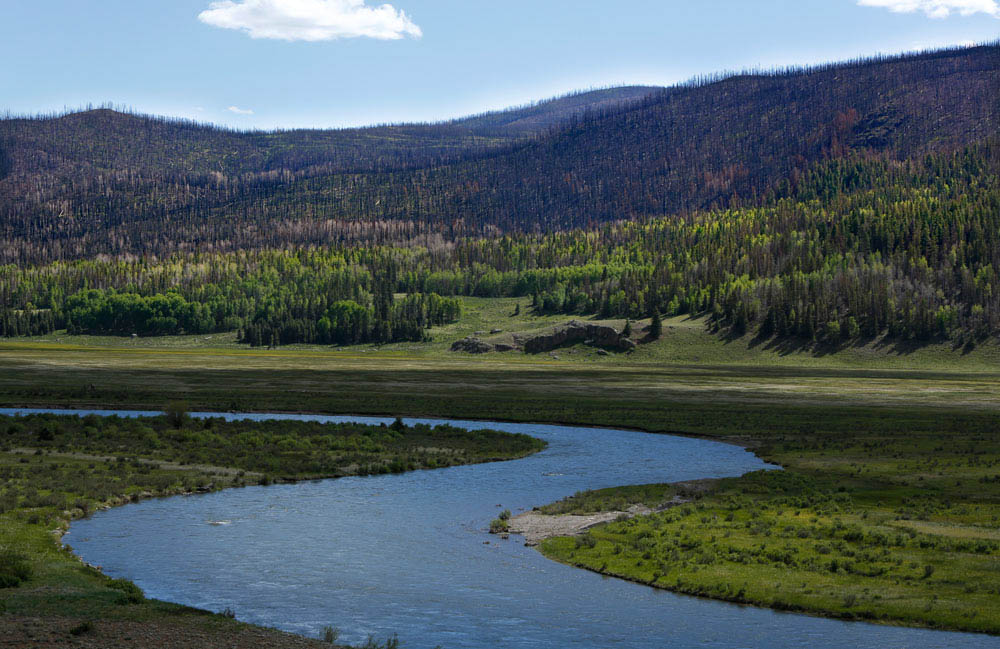
We are starting our expedition on the Rio Grande as the local counties work to set up an early warning system for flash floods and debris flows.
The West Fork Complex fire ripped through these mountains last summer, leaving more than 109,000 acres of charred forest in its wake. With few trees left alive, there is little to hold back the rain and snowmelt. Floods are considered inevitable.
Conditions were ideal for a big burn in June 2013. The forest was packed with trees that had been decimated by beetles and the area was in the middle of the worst drought in generations.
The fire, started by lightning, burned out of control for almost a month. It sent up a smoke plume that rose above 30,000 feet and terrified local residents. The entire tourist season was shot as the highway closed and the Rio Grande ran black.
Now it is running clear, but the rains have been light and the monsoon season has yet to begin.
The parts of the spruce forest that were severely burned could take centuries to recover, said Mike Blakeman of the Rio Grande National Forest.
For Mike, it is personal. On June 26, 1993, he got married. The backdrop for the ceremony was a cliff overlooking the Rio Grande National Forest and the mighty spruce forest. The judge joked the spot was chosen so Mike could not back out.
After the ceremony, family and friends celebrated with a snowball fight. Such snow would never have allowed such a large fire like the West Fork Complex, Mike said.
Now there is no snow in sight except for the tops of mountains and a new forest is taking shape. The grasses and sedges of high mountain meadows and stands of aspen will replace the spruce.
“The fires caused a lot of hardship,” Blakeman said. “But as a person with a natural resource background, I really enjoy watching the recovery.”
To comment on this post or ask a question, please visit the expedition's Facebook page.


While making his way to the Gulf of Mexico, Colin will be periodically activating a device that uses satellite technology to share his current location. Use this map to see where he traveled on this day.
| Check-In | Time of Check-In (CST) | Latitude | Longitude |
|---|---|---|---|
| #1 | 3:05 p.m. | 37.6488 | -107.06197 |
To report on and understand the haphazard irrigation system the Rio Grande has become and the changes it is going through, Colin decided the best approach would be to travel the length of the Rio Grande by foot and small boat.
He knew it would give him a unique perspective on a river that few understand. It did require many long days of moving slowly and camping on muddy riverbanks, but Colin likes that sort of thing.
The benefit was it provided access to people who wanted to share their stories and experiences with the Rio Grande. Via Facebook and chance encounters, Colin made instant friends who opened their homes. They provided help from loaning their trucks to their cell phone contact lists to help tell the story of the Rio Grande.
The trip would not have been possible without their help, along with the dedicated assistance of David Lozano, Jason Jones and Daniel Dibona, who drove thousands of miles to get people and boats in place.
Contributors